Previous Story
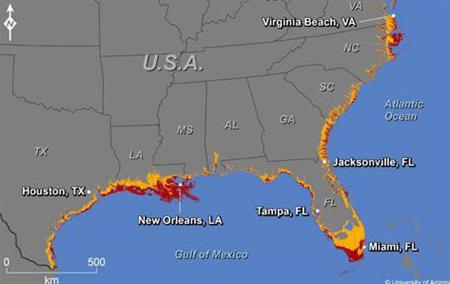
A map showing where increases in sea level could affect the southern and Gulf coasts of the U.S.
Posted On 28 May 2014
Comment: 0
A map showing where increases in sea level could affect the southern and Gulf coasts of the U.S. The colors indicate areas along the coast that are elevations of 1 meter or less (russet) or 6 meters or less (yellow) and have connectivity to the sea.
REUTERS/Jeremy Weiss/University of Arizona